


All around the world, there are many of us who dwell in major cities, or travel to urban locations, that find the need to use the local urban Metro train systems of these cities for our day to day commute. Whether we use these Metro systems to get us to work on time, or go out to play in the parks, get to the local movie theatres or local restaurants, or even are tourists that are trying to see the sites, we all appreciate the Metro railway systems in these urban areas for being fast, inexpensive, and a convenient mode of transportation to use. Thats what the Metro trains are for us. They are a public or private service in some of the largest Metro areas on earth. Subway and above rail systems in these Metro areas make our lives easier and let us get to where we want to go quickly and in a timely manner so that we can do what we want to do. You want your urban Metro transportation to work for you. Metro is the train map iOS app that is perfect for you. It will ensure that you get where you want to go in the current Metro area you are either living or visiting in, and will give you quick and efficient service and mapping information that will enhance your ability to enjoy the Metro transportation services you already expect and have come to know from your Metro rail system that you use daily, or need to use on your current trip or vacation.
Metro is a map app that is simple to use. It will quickly bring up the Metro train system maps of the local urban area that you are currently living at or visiting. Metros maps comprise of underground subway systems as well as any elevated rail lines connected to your citys Metro train system. As you know already, a citys Metro train system is the fastest, cheapest and most convenient mode of urban transportation. Metro trains are run on electronic passenger railways that help commuters to live their daily lives. You can find Metro rail and subway systems interwoven into major cities all across the globe. They are the fluid blood flow of the heart of the urban Metro areas, allowing for a greater capacity of people to move about freely and frequently in their most crucial daily commutes, making the Metro rail a class apart from other means of transportation.
APP FEATURES
● Simple, fast and easy to use.
● All Maps organised by Country List and City List.
● Designed for the first time visitor and experienced commuter.
● Works in both landscape and portrait modes.
● Provides the latest official metro, underground, tube, subway maps.
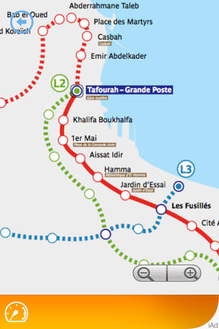
The Metro train map app will show detailed tracks for many of the worlds largest urban Metro railway systems, their stations, major interchanges, and helps shows you all the track lines connected to the Metro rail system. The rail maps section on the Metro app classifies the basic continents upon which the most important Metro rail maps have been taken. The Metro map app is designed to ensure that even both the first time visitor and the experienced urban commuter will find it easy to use and most helpful to get the information they need to make the best decision on what tunnels and trains in their local urban Metro rail system will get them where they want to and the quickest route possible.
Metro iOS app provide detailed maps of London Underground Map / London Tube Map, New York subway map, Paris metro map, Frankfurt U-Bahn, Amsterdam Metro Map and other popular map from all over the world